Showing posts with label Worldmark. Show all posts

Friday, February 17, 2017

Photo Essay from Las Vegas, Part 1

A blog post about Las Vegas should include lots of photos of the Strip, of lights and glitz, shows and show girls, booze and buffets.  This post will have none (or very little of that). We did spend time in several casinos--some we'll even tell you about--but for us the trip was filled with golf, hiking, Native American art, and a few other surprises.  I have too many photos for one post, so I'll let the photos tell the story of our Las Vegas holiday in two posts.


It was an icy, dicey drive to Portland airport to start our trip.


A good flight from Portland to Las Vegas on Southwest got us off to a good start.
Our digs for the week were at the Worldmark (timeshare) Las Vegas Blvd. about four miles south of the MGM Grand and the Strip.


We stayed in a one bedroom unit. It looks a little empty because they leave room for the murphy bed to drop down out of the wall.  We could sleep four in the unit.

Our first golf of the trip was at a course new to us, Desert Willow GC in Henderson. The executive (par 3s and par 4s)was in excellent condition and was both relatively easy and yet challenging.  It's a course we will plan to play again.
A friendly local watched us tee off at Desert Willow.

We were impressed with new housing development just off the course. In the future the course will offer a view of a stair-step hillside of multi-million dollar homes.  That may change our mind about playing it more.
The next day we visited Red Rocks Canyon National Conservation Area a few miles southwest of Las Vegas proper. Being so close to the city, it's a busy park with a plethora of hiking and climbing trails.  The weather was less than perfect with rain and low clouds all morning.
Even with little sun, this jumping cholla cactus was lovely--just don't get too close.

Anne leads the way on a short hike from the parking area at the Willow Springs Picnic Area to get the small group of petroglyphs.
This site is one of the smallest we saw during the week, but several of the petroglyphs (pictures carved into the rocks) were different than we saw elsewhere.

Anne at the information plaques near the Willow Springs petroglyphs.
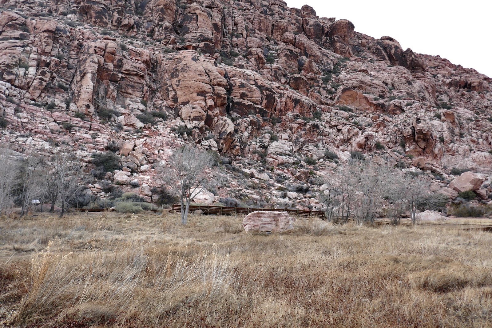
Not all the rocks at Red Rocks Canyon are red.  The park has a nice variety of geological formations with easy access.


The wind at Red Rocks was really howling. I'd estimate we had gusts of 80 mph or more at times. At the High Point Overlook this lady was being held up by the wind as she leaned into it.  I had difficulty holding still enough to get a picture.
At the Lost Creek site I hiked out for a view of an unusual water feature--a waterfall spouting directly out of the rocks. The trail was easy for about half a mile and then quite overgrown for the next half mile. I found a good view without going the whole trail.
After Red Rocks Canyon we visited a nearby site that was supposed to have petroglyphs,  Red Springs. We hiked the mile boardwalk trail without seeing any petroglyphs.

One of the locals at Red Springs.
A highlight for me was a tour of the Pinball Hall of Fame on Tropicana. Pinball was an almost weekly activity at the Blue Moon Tavern in McMinnville when I was in college at Linfield. They had machines where you could actually win money (they paid off like slot machines) as long as the local copper wasn't around.

I didn't find my favorite old machine, but I plunked in a few quarters in this oldie. And where in the hell did my reflexes go, anyway?


Our second round of golf was at Las Vegas National GC in Las Vegas. This old course is lined with homes once owned by stars of stage, screen, and sports.  We passed a house owned at one time by Dean Martin and another owned by Sugar Ray Leonard, the boxer. Besides the interesting surroundings, the course is made up of classic good golf holes. 

We had an encounter with one of the current residents. Sorry the picture of the coyote is a little fuzzy; I was driving the golf cart down the hole, holding the camera in one hand, and Wiley was running by. As a grab shot I don't think it's too bad.
One day we drove about an hour out of town to the Valley of Fire, Nevada's first state park. Named for the red sandstone formations, the park has numerous types of geological features, many hiking trails, and several areas with fine Native American petroglyphs.


The lighting in the Valley of Fire was great this day.  I had fun with the play of sun and shadow on the rocks and vegetation.


An example of the red sandstone formation giving the park its name.

This formation is known as a bee hive.


The dead plants, live plants, and small rock caves create some interesting effects.


I was fascinated by the bush skeleton framed by the red sandstone.
Anne on the 3/4 mile round trip trail to Mouse's Tank (aka petroglyph canyon).

On the trail to Mouse's Tank, a natural basin where water collects, we encountered our first petroglyphs at Valley of Fire.

This rock, covered in what's called "desert varnish," is covered with petroglyphs.  Rocks with numerous carvings or glyphs are often called "Native Newspaper."

A closer look at one of the "newspapers" along Mouse's Tank trail.

Here's an example where most of the "Desert Varnish" and its carvings has worn away leaving only a little of what once was probably a large collection of petroglyphs.


About the photos: All photos taken with either a Lumix DMC-ZS100 (point and shoot) with 25-250mm zoom, or Lumix GX85 (interchangeable lens mirrorless) with 14-140mm or 7.5mm lens.

Next: More of the Valley of Fire and the end of the Las Vegas trip.


Monday, November 7, 2016

A Photo Essay: Northern Oregon Coast Trip

A two day photo safari of the Northern Oregon Coast, November 1-3:

     With our friends, Nick and Kathryn Delany, we planned a two day trip to the northern Oregon coast for a photography exercise. We met in the afternoon at our timeshare in Seaside, the Worldmark Resort, spent the evening together, took some photo excursions the next day, and here are my results, with some help from Nick. Since a picture is worth a thousand words, here is a small book of thirty-six word-pictures of our beautiful coast.
The Cedar Creek between Grand Ronde and Hebo. 
In Tillamook Anne and I stopped for a cheese orgy, first at Blue Heron French Cheese Company and then at the Tillamook Cheese Factory.

A Highland Coo is one of the menagerie at Blue Heron Cheese.

This small gauge engine and rail car is on exhibit at Blue Heron.

Also at Blue Heron were several Guinea fowls. I've eaten them in Scotland, but had never seen one close up.

The Tillamook Cheese Factory is much larger than Blue Heron.

One of the features of the Tillamook Factory is the viewing platform where you can watch cheese being processed.
Along the coast between Tillamook and Seaside Anne and I made several stops--one for lunch, but mostly for photo opportunities.

By Bay City we saw several rocks loaded with cormorants and gulls.

At Hug Point State Park, a short hike got us down to the rocky beach and this lovely scene.

Only a couple of miles past Hug Point is Arcadia Beach with its broad sand beach.


Anne and I were still early for our check-in time at Seaside and our meeting with the Delanys, so we took a walk in one of Oregon's quaintest tourist towns, Cannon Beach.

The interesting mural decorates the walk to an entertaining attraction in Cannon Beach.

The Cannon Beach Distillery offered up tastings of their several gins and rums--Anne did the tasting since I'm the driver.
At the Worldmark Resort in Seaside we met up with our good long-time friends Nick and Kathryn Delany who now live in Vancouver, WA.  Kathryn is a working artist (ColorSplashes.com) and Nick, recently retired, is just getting started in fine art photography.


Anne, Kathryn, and Nick walking back towards Worldmark on the Seaside Prom.
After a good breakfast in one of the local beach-side restaurants, Maggie's, we headed out of Seaside to find subjects for Nick and I to shoot, digitally of course.  The ladies hiked along--Anne and Kathryn took their own photos and gave the guys creative encouragement. Even though the weather was not the best (but it was typical Oregon), I managed to get some showable images.

The first stop was Ecola State Park just north of Cannon Beach--this view is to the south from the park.

It would have helped to have clear weather, but I was still able to get this image of Tillamook Rock Lighthouse about a mile and a half off shore.

Next we visited Ft. Stevens State Park on the most northwesterly tip of Oregon. On Columbia Beach we tried to catch beach reflections of the Peter Iredale shipwreck.

Nick caught me walking back from taking the picture below.
Columbia Beach

A seaweed bulb on the beach.

While photographing the shipwreck we were approached by a KPTV Portland cameraman on assignment to get reactions of locals of a small earthquake that occurred offshore that morning. Since the biggest reaction he got was one lady who said the quake felt like the cat jumping on her bed, he came down to the Peter Iredale to do background photos.


Up from the beach, we explored one of the batteries at Fort Stevens which had been built originally in the Civil War era and then reinforced in both World Wars. This is the Commander's Quarters.

In World War II this battery housed two large gun emplacements.

A couple of interior shots of the battery.


Before we left the fort, we stopped at the south jetty of the Columbia River where waves were crashing and pelicans were flying--this shot is from a long way off.

Isn't technology wonderful! As were driving Kathryn found details about this cafe for lunch in Warrenton.

And at Arnie's Cafe I discovered a huge, sinful treat--a fresh, hot cinnamon roll. I justified the sweet treat by saying I was braving the elements for my art.

Across the Columbia River into Washington state we hiked out to the decommissioned North Head Lighthouse.


That evening we ate at one of our favorite beach restaurants, Dooger's in Seaside.

Seaside on a rainy evening.
The next morning it was again breakfast at Maggie's on the Prom in Seaside before we headed back home--Delanys to Vancouver and we to Canby.

The Seaside beach with Tillamook Head in the background.

Anne at one of the lookouts near Oswald West State Park.

The view south on a brighter day. Of course, it's expected that the weather turns nicer just as you leave the beach.

One of our finds on the way home was this little shop, Bear Creek Artichokes, 11 miles south of Tillamook on Hwy 101. Homemade pestos, scones, and jams all made it into our shopping bag.


The weather wasn't great, but it wasn't terrible either. The company was terrific, and I look forward to seeing what photos will come from Nick's work.